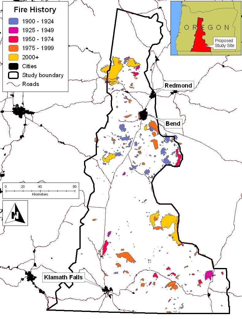
Fire History polygons represent the final mapped wildfire perimeter. These data are maintained at the Forest / District level to track the area affected by fire. Spatial data is stored via a regions feature class due to overlapping fire perimeters. Robert J. Sherman and Karen Curtis, Deschutes National Forest Fire staff. Additional fire history polygons were acquired from Laurie Campbell, Winema and Fremont National Forest staff.